The Air Force is Just a Great Big Aero Club But Way More Fun
We’re very pleased to have Bob Henderson back again to regale us with flying adventures that are not normally available to most of us. Here, Bob gives us three more stories - and a couple of them seem like scenes straight out of a action movie!
Over to you Bob!
‘Everyone is welcome
Everyone contributes
Everyone grows
Everyone gets home safely’
My flying story starts with the second world war - my father flew Spitfires in Europe and then Corsairs from a carrier in the Pacific.
After the war he never flew again as a pilot. However, for my 10th birthday he gave me a flight in – I think it was - a C172 with the Wairarapa Ruahine Aero Club and that was the beginning of my love affair with the freedom of flight.
On June the 24th just 8 days after my 16th birthday, and with just over 6 hours dual, I was sent solo in the little Bolkow 208 CFJ - to this day I have no idea how I was able to fit into that tiny aircraft. (Melissa here. Bob is well over six feet – he towers over everybody!)

Bolkow 208 CFJ - the plane Bob had to take his legs off to fit inside!
In January of the next year, 1968, I was privileged to complete an ATC flying scholarship with the RNZAF flying the Harvard at Wigram. We weren't allowed to solo but I logged some 10 hours. In 1970 I started with the Air Force as a University Cadet studying at Canterbury University.

Flying the Harvard at Wigram
I spent most of my Air Force career involved in Transport and VIP operations. I had the opportunity to go to some corners of the globe at some very interesting times.

RNZAF aircraft types flown by Bob
Here are three stories from adventures had.
I would ask you to remember, as you read my yarns and wonder where the CAA Rules were, that one of the privileges of being a military pilot was that sometimes you were expected to get the job done and to take care of your team at the same time.
So, let's launch ourselves back to the future and May 1983.
I was a senior pilot on 42 Squadron flying the venerable and hugely powerful Andover with its 5.5m props - only the Russian TU-95 Bear had larger props at some 6m diameter.

Top left - the mighty Andover with it’s 5.5m props!
The Government decided that the New Zealand Ambassador to Indonesia should go on a month-long trip around the Indonesian archipelago travelling north and east from Djakarta to lrian Jaya and then back through East Timar - now Timor-Leste - to Djakarta.
We were to be the first western military aircraft to land in Dili, the capital of East Timar, since the invasion of that country by the Indonesians seven years previously in December 1975.
While in Djakarta, we picked up numerous airfield plates and charts for the various airfields we were to visit. This included a place called Wamena, which was at 5,000ft above sea level in the mountains of lrian Jaya. Fortunately, it was a fine day when we got to that stage of the trip.
A couple of days later we were planned to fly across the Banda Sea from lrian Jaya to Dili. The forecast was for a wet arrival into Dili with low cloud under an eastbound tropical low pressure system.
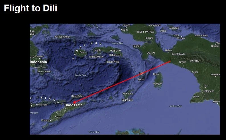
Planned Route to Dili
Being diligent operators, we looked carefully at the airfield charts we had been given - courtesy of Garuda Airlines. The only approach provided was an NDB (Non Directional Beacon) and we decided that we were a little uncomfortable trusting ourselves to an NDB approach to an airfield that had only been visited by Indonesian military since 1975.
So, expecting cloud and rain we loaded lots of fuel. Then we worked on our strategy - fortunately with the assistance of an ex 5 Squadron Orion Navigator on our crew (the Andover carried 2 pilots and a navigator - sheer luxury!). We agreed that the Orion fishing patrol cloud break procedure might be beneficial to us getting the Ambassador to his next appointment – dinner with the Governor in Dili.
Sure enough, the weather deteriorated as we headed west, cloud filled the sky and our radar was indicating increasing rainfall in front of us as we neared the Dili coast.
Of course, what do you do for a QNH when you're - literally - in the middle of nowhere and have little faith in what a person in a control tower might chose to tell you! Another reason why the tear-drop NDB approach across the spine of the island was not attractive.
Instead, we set the aircraft up for a gradual descent with the – fortunately - long and fairly straight coastline clearly showing on the radar to our left, and flying at an angle of 45 degrees to the coast - so there was always an escape heading to the right and climbing out over the sea. With the radar altimeter set to 200ft and the aircraft set up for an approach and flying 500ft/min rate of descent we dropped down through the clouds. Our aim was to break out by 200ft above the sea and a couple of miles clear of the coast - or pile on the coals and climb away to the north.
The plan worked - we were clear of the cloud base, above a fairly calm sea, at just above 200ft and able to see the coast out the front windows. Turning left across the harbour lined us up with the runway and we delivered the Ambassador on schedule for his dinner.
Later that evening, while enjoying dinner as guests of the Governor, our Ambassador commented to me that it seemed to be a "very large yacht that we had flown over as we approached the coast". I assured him that it was only about 12m long.
So, onto other adventures…

Bob, Ryiadh, 1991, Captain of crew 1
At the beginning of 1991, I was privileged to lead 40 Squadron, my pilots, crews, engineers and a support team, to Gulf War 1. We were located in Riyadh, the capital of the Kingdom of Saudi Arabia and about 2 hours flying from the front line on the Kuwait border. Of course, our accommodation was appropriate for the circumstances being only 5 minutes from the flight line at King Khalid International Airport.
My next two stories come from there.

Bob’s Kuwait Accommodation! Because it was the closest to the Flight line.

The Flight Line - serious looking Military kit!
The first happened because our Hercs were equipped with Inertial navigation platforms, and this gave us great accuracy for any navigational requirements - like down to metres.
My colleague, Peter Bedford of the RAF, only had Loran C in his Hercs. This is an area nav system, it will get you to the general area but not great for accurate navigation.
We had 2 Hercs, Peter had 7 and we combined our resources to provide transport and tactical support to the British troops on the front line carrying anything from mail to fresh food to troops to ammunition and mines and even blood.
On a sidenote - Peter's father was Bill Bedford, one of the original test pilots on the Brit V-STOL programme and later the Harrier. He had to eject one day during a test flight of a Harrier when the nozzle mechanism jammed, and the aircraft rolled inverted - at 500ft above the ground. Bill's seat fired him out parallel to the ground!
In late January 1991, my crew and I were tasked with picking up a group of Special Forces from immediately adjacent to the Kuwait border. We asked what airfield - the nearest being Al Jubail, from which F18's were operating and which was some 200km from the Kuwait border.
"No, not Al Jubail, but a strip right on the border, almost within sight of the sand berms put up by the Iraqis to stop tanks."
"OK - how do we find this place and what's there?"
"Here are the coordinates, it's laid out on this heading and is some 3000ft/900 m of flat, firm sand - at least that's what the engineers with the troop have told us."
"Right - wish us luck!"
Off we go, below 10,000ft and at 250 kts flying VFR and semi-quadrantal headings in radio silence - which was the norm for all transports (Hercs, Transalls, DC10's, 747s -the lot!) with 2 hours to figure out a plan.
The AWACS circling overhead was our mother ship, but they couldn't really help us - except to send in the cavalry- the F16s - if someone got upset about our position close to the border.
So, with the (hopefully correct) coordinates of the end of the runway coded into the inertials we set up an approach to the north from 2000ft, gear down fully configured, looking out over this enormous, vast plain of golden sand.
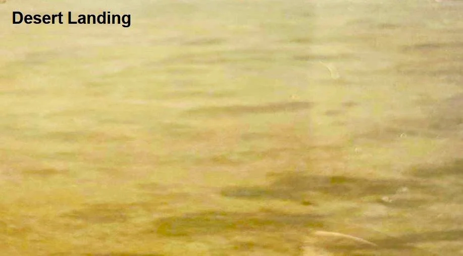
Spot the landing strip! 🤔
There were no runways markers, no sign that there was anything there, no humans - nothing but sand for miles.
All eyes were on the flight deck - 2 pilots, navigator, flight engineer and 2 loadmasters - everyone looking for some reason to justify risking putting our wheels on the sand.
For the perceptive folks here -you're right - the loadmasters were not strapped in; neither was the navigator- the 3 of them were standing – so that they had clear views out the Herc's panoramic windscreens – behind the pilot and flight engineer seats. If we stopped in a hurry the idea was they would come up against the back of the seats and not end up in the controls!
The brief was simple "we go down to 1 metre off the sand and then go around - unless someone - anyone - sees something that convinces them that we are in the right place."
Down and closer, down and closer and nothing - until at about 100ft one of the loadmasters yells
"There's a flag!"
Of course, normal human reaction, everyone else yells "WHERE?"
"There by that rock - a little black windsock!"
Sure enough it was there - about 1 m high and 30cm long - and we were landing downwind!
An executive command "Hang on - we're landing" was followed seconds later by the wheels spinning up on the sand and the props being slammed into full reverse and held there.
Down safe - the loadmasters ran into the hold and cleared us to open the ramp as we were still slowing. Figures suddenly appeared from behind small clumps of sand and the odd rock and raced towards the slowing Herc.
By the time we were going slow enough to do a 180 degree turn nearly all the soldiers were on board and jammed into the cargo hold sitting on the floor. A quick check that their headcount was correct while the pre-takeoff checks were completed and we were at full power heading south and getting airborne even while the ramp was completing its closing sequence.
A good day out and a bunch of very happy, sun and wind burnt soldiers on board.

Very relieved lads - leaving the front line - in Bob’s Herc.
By the way, a measure of how valuable our inertial nav systems were came from the rate of completion of our joint tasks. Peter had 7 Heres, I had 2 - so basically each aircraft should have achieved 11 % of the total Brit in theatre transport. We Kiwis completed 30% of the total in-theatre tasking.
I am proud of the efforts of the Kiwi team; it's why our air force has such a great international reputation.
The next adventure I want to share started on the 28th of February 1991, the day the ground war ceased.
We were tasked with flying the Brit Ambassador back to his Embassy in Kuwait City that evening and, the next day, the 1st of March, to carry the senior British officer, General Peter de la Billiere, and his staff to Kuwait International Airport (or what was left of it) to set up the peace talks with the Iraqi Generals (or what was left of them!).
After a game of paper, scissors, rock my colleague, Peter Bedford won the privilege of flying his Ambassador to Kuwait and that left my crew to take de la Billiere and his team to Kuwait for the peace talks the next morning.
When he got back to Riyadh, Peter briefed us all that they had great difficulty finding Kuwait airport because of the fires that the retreating Iraqis set in the vast oil fields between Kuwait City and the Saudi border. Peter and his crew had stumbled around above and then in the smoke and finally located the airport. There were no navigation aids functioning of course and his crew found the exercise rather stressful!

The roiling smoke clouds above the burning oil fields.
We all agreed we needed a more reliable way of finding the runway at Kuwait. So, the next morning I am taking the General and his staff to the peace talks and our intention was to see if there was a viable pathway to Kuwait City underneath the base of the oil smoke.
We headed north from Riyadh, crossed the border and then dropped down to look under the smoke layer.

Below the oily smoke clouds
The picture above does not do reality justice - it was taken on the very edge of the fires, just before we entered the fiery hellscape, and the columns got denser the further into the oil field one went.
It looked reasonably doable, and our escape path was to go full power and straight up out the top of the smoke - the Herc will climb some 3-4,000 feet at full power with a pitch angle of 25 degrees even with a moderate load.
Once established under the smoke layer, which was at about 4 to 500ft we found another wee challenge. Every well head in the extended oil field seemed to be on fire and the column of flames from each went straight up into the base of the cloud. It felt a bit like something from Indiana Jones and the Temple of Doom - constantly looking ahead to figure out where to place the aircraft to go around - not the next column of fire, but the 3rd one after that.
At least the base of the smoke was a consistent 4-500ft.
Weaving our way through the fires seemed to amuse our passenger who had invited himself to the flight deck to watch.
Unfortunately, we had given him a headset so the flight deck conversation was rather more polite than it might have been, given how hard we were working - especially when we went ‘fairly close’ to some huge high-tension pylons - above us - that were some 5km out of position compared to the maps we were using!!
We got to Kuwait City safely and landed and the General went off to the peace talks.
That night the Herc crews all had another brainstorm - dodging columns of fire was not a great game to play AND the aircraft and windscreens were filthy from a fine sheen of oil.
Another way had to be found and that was pioneered by our youngest Captain. The harbour shoreline at Kuwait City is very distinctive and it curves around - a bit like Wellington harbour. There happened to be a single, long wharf that was aligned perfectly with the centre line of the left-hand southern vector at the airport. The sea end of the wharf was some 13km from the threshold.
Tom and his crew decided to navigate to the end of the wharf, following the coastline and aided by the aircraft radar, set the aircraft up with the gear down, fully configured for an approach from 2000ft as they crossed the seaward end of the wharf. The navigator did his best to provide a talk down using the radar - a technique used in Antarctica (Melissa here - this story arrives soon!) for landing at McMurdo on the ice runway through low cloud and in fog - and the approach took the aircraft, successfully, right to the threshold.
So, we had found a safe way into Kuwait City for the rest of our time there and we all made good use of our mock "PRA Approach".
Incidentally, taking off was easy - a check with the AWACS that there was no traffic close to us and then full power and an IFR climb to on top of the smoke. One advantage of flying in a country without any significant hills!